


CarryMap

Description of CarryMap
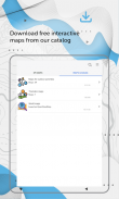
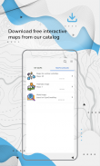
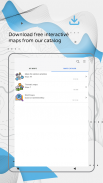
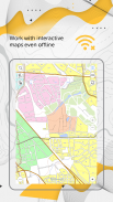
CarryMap is a mobile application designed for seamless map access and field data collection. This app allows users to work with various maps without the need for authorization, payments, or in-app purchases. Available for the Android platform, CarryMap enables users to download maps prepared in ArcGIS or access free maps from its catalog, which are based on OpenStreetMap data.
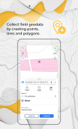
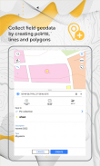
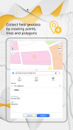
The application supports the addition of custom maps, allowing users to tailor their mapping experience to their specific needs. Users can create and edit geographic features such as points, lines, and polygons directly on their mobile map. This functionality is particularly useful for professionals in fields such as agriculture, geology, and urban management who require precise geographical data for their projects.
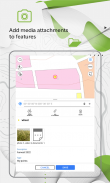
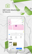
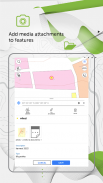
CarryMap also allows users to enhance their data with multimedia. It is possible to attach media files, including photos, videos, and documents, to different features on the map. This capability facilitates a richer data collection experience, where visual context can accompany geographical information, making it easier for users to convey their findings to colleagues or stakeholders.
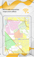
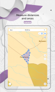
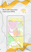
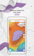
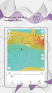
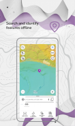
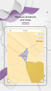
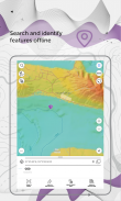
Offline functionality is a crucial aspect of CarryMap. Users can search for and identify features without needing an active internet connection. This offline capability ensures that essential data can be accessed during fieldwork in remote locations where connectivity may be limited or nonexistent. Additionally, users can measure distances and areas directly within the app, further assisting in field assessments.
For those who need to create points in real-time, CarryMap offers a feature that allows users to generate points using their device camera. This innovative tool simplifies the process of data collection, enabling users to capture relevant geographical points swiftly and efficiently.
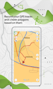
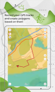
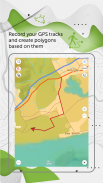
The app includes GPS functionality, allowing users to record their GPS tracks and use this data to create polygons. This tracking feature is beneficial for users who need to document their movements or map out specific areas of interest accurately. Furthermore, CarryMap supports the use of external GPS receivers, such as the Bad Elf GPS receiver, enhancing location accuracy for fieldwork.
Users can save selected map areas as bookmarks, providing quick access to frequently used locations. This feature streamlines the workflow, enabling users to focus on their tasks without navigating through extensive map catalogs each time. CarryMap also allows users to utilize map features as landmarks or destination points, facilitating better navigation in the field.
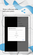
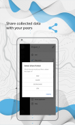
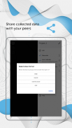
Data sharing is another essential function of CarryMap, as users can export collected data in multiple formats, including GPKG, GPX, KML/KMZ, and SHP. This versatility in data export makes it easier for users to collaborate with peers and integrate their findings into other software or mapping systems.
The app caters to a diverse range of professionals, including specialists in electrical energy, water resources management, ecology, and incident management. These users benefit from the app’s practical features, which help address everyday job tasks related to mapping and data collection.
CarryMap is designed for users who need a reliable mapping solution that functions effectively in various environments. It provides a comprehensive suite of tools for field data collection, map editing, and multimedia integration. The app’s user-friendly interface allows for efficient navigation and utilization of its features, making it accessible for users of different skill levels.
The versatility of CarryMap extends to its ability to support maps in the specific mobile format CMF2. For users looking to export their ArcGIS maps to this format, CarryMap Builder is available as an extension to ArcGIS Desktop. This integration facilitates a smooth workflow for users who rely on both CarryMap and ArcGIS for their mapping and data management needs.
CarryMap stands out as a practical solution for professionals across various industries who require effective map management and field data collection. With its extensive features and offline capabilities, users can rely on this app to support their work, regardless of their location. The ability to download CarryMap enhances the accessibility of this tool, ensuring that users can take advantage of its capabilities whenever needed.
For more information about CarryMap, visit https://carrymap.com. You can also reach out with questions or comments at support@xtools.pro. Stay updated by subscribing to our Facebook page at https://www.facebook.com/carrymap/ or our YouTube channel at https://www.youtube.com/c/CarryMap/videos.


